Descending Tourmalet
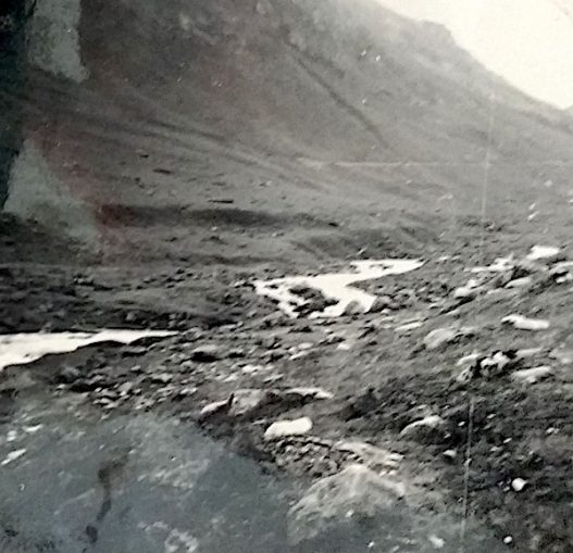
Having conquered the 7,000ft Col du Tourmalet for England, our pugnacious Ford 8 trundles down the other side nonchalantly taking for granted the now over-familiar spectacle of Pyerean mountain passes. The cycling data tells us a brake-burning 12 mile drop from the summit sees the gradient vary from 1/10 to 1/25 with no respite from any level ground.

© Always Worth Saying 2022, Going Postal
© Always Worth Saying 2022, Going Postal
Lux-Saint-Sauveur
At the bottom of the valley sits the village of Luz-Saint-Sauveur at which point, perhaps surprisingly, we head south back towards the Spanish border. Surprising because at first glance the road leads to nowhere other than the end of a mountainous cul-de-sac. Known as Luz, the locals are called Luzeans and reside in a pleasant mountain village clustered around St Andrews Church of the Hospitallers of St John of Jerusalem. Those hospitallers being better known to us Anglo-Saxons as the Knights Templar.
A fortified structure within its own castellated wall and originally surrounded by a moat, St Andrews was so-built to protect against raids by Spanish bandits known as ‘irregulars’, as if Reivers from my own Debatable Lands.
Old friends of Nostalgia Album Napoleon III and Princess Eugenie (whose summer palace my father and grandparents previously stood before on Biarritz’s Grande Plage) fell in love with Luz and donated a nearby bridge across the river Gave which was inaugurated by the Emperor in person in September 1863. The Gave flows under the crossing and heads north until it joins the Adour which in turn joins the Atlantic within sight of the north-facing upper windows of the Empress’s Biarritz summer retreat.
While we’re on the subject, can Puffins think of any English river that flows south to north? And, no, I don’t mean a tributary and I don’t mean north-ish while heading east or west. I mean north proper. An interesting challenge for Puffins, answers in the unread comments please. The Nile isn’t in England, house point deducted.
As we head south and uphill from Luz alongside the river Gave and driving towards its source, we pass over Napoleon’s bridge. At this point the road is crossing a steep and narrow gorge, spanned by an impressive structure 74 yards long and just over 200ft above a river running beneath an arch that is 50 yards in diameter. On the eastern side stands a column commemorating Napolean III erected by the local Chamber of Trade. Consisting of 12 rings it is topped by an impressive imperial eagle with wings outstretched. While looking for the bridge and monument, I found another Luz-Saint-Sauveur commemoration to Napoleon III which can be viewed here.
A rather bleak piece, erected on a sombre aspect of exposed rock above the village, it demands a Henry Lincoln trilogy linking the Knights Templar to Napoleon III and my own ancestors. A weathered inscription might be extrapolated to a 3D word cube which, when overlayed by a pentangle, should reveal a unifying prophecy linking the Knights, the late Emporer of France and a weary Ford 8. ERM 3, 1952, due south, Car-liz-lee, lies hidden there somewhere.
The Gave gives its name to Gavarnie Gedre, 5 miles south of the Pont Napoleon. Here, a tributary from another valley joins from the southeast. We head southwest, following the Gave until we reach the village of Gavarnie four miles on.
Garvarnie
© Always Worth Saying 2022, Going Postal
© Always Worth Saying 2022, Going Postal

© Always Worth Saying 2022, Going Postal

© Google Street View 2022, Google
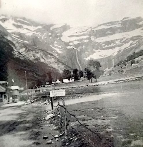
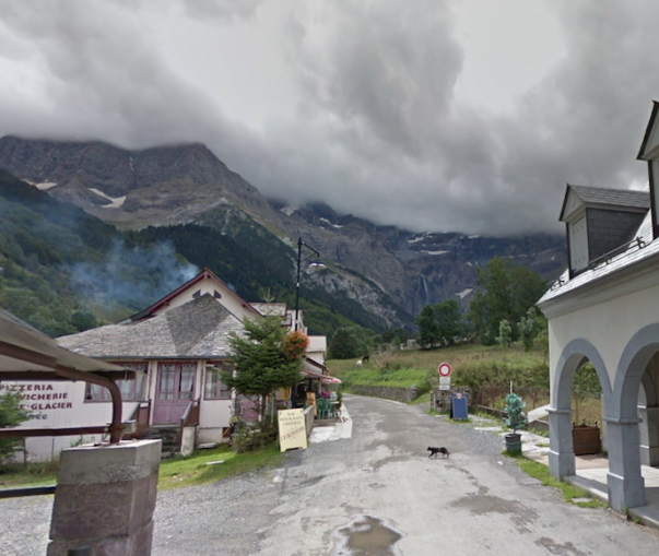
At first glance, the two images immediately above might not seem like a match but they are. Look at the unusual domed chimney top next to the slater and closest to the camera on the left-hand side. And the double pitch in the roof, the outcrop of which allows a full-sized doorway into a sloping building part of which is below street level. This is now a shop.
Further down the street and on the right-hand side is a single old-style petrol pump in front of a black shed. The sign before the pump reads ‘Garage Central’. On today’s Street View image, beside the parked coach sits the Cafe Central and beyond that a scruffy piece of land where a few old cars are parked.
In the distance can be seen the Gavarnie waterfall tumbling from a mountain ridge only yards away from the Spanish frontier. A reassuring amount of snow about both photographs helps to further debunk the global warming myth. You can have a good look around the Street View Central Garage here.
In the old photograph, a gable end announces the ‘Restaurant L’Astazou’. If we wander down the main street, the Arribere Dessus, we discover the Astazou is reassuringly still there and in excellent order although partly obscured by some new buildings one of which, the Brasserie Mouzgat, worryingly flies the German flag.
© Always Worth Saying 2022, Going Postal
© Google Street View 2022, Google
By a trick of perspective, the waterfall looks smaller in the top photograph than it does in the old ‘slater’ image even though we are closer to it. The buildings to the left, one with a pitched roof, one with a flat, can be identified in the modern day. There is a new building on the right where an abandoned-looking Terminus Garage sat seven decades ago. You can have a scout about the exact spot via this link.
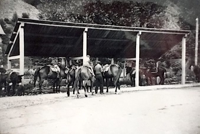
In the recent image in the bottom left-hand corner can be seen a breeze block pillar holding up an enclosure for trekking horses. Consisting of a metal frame and corrugated plastic roof, it is very similar in design to the much more handsome wooden structure pictured below. In the modern day, M. Christian of the Club Equestre Vignemale is
“Waiting for you to make you discover the paths of the Cirque de Gavarnie in complete safety. His horses, of Mérens race are perfectly educated and adapted. The merens is native of the High Valley of Ariège, in the Pyrenees. Agile, not too big and with a sure footedness, it is the versatile horse par excellence, an expert in hiking. It has drawn its qualities from the mountains: rustic, it supports well the climate of Gavarnie.”
© Always Worth Saying 2022, Going Postal
Last time on Nostaliga Album, your humble author, despite his country origins, was forced to concede he knew nothing about coos. This week he must confess the same regarding hosses. Having said that, he suspects the shorter, stockier beasts to the right of the old photograph to be Mérens and those to the left to be a nimbler breed. Note the boy to the left with bare feet well short of the stirrups.
© Always Worth Saying 2022, Going Postal
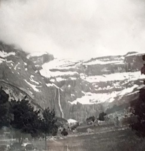
Whether on horseback or on foot, my father and grandparents made their way towards Le Cirque de Gavarnie, described by Victor Hugo as “the Colosseum of nature”. The rock walls surrounding the mountainous amphitheatre rise up to 4,900ft above the floor of the Cirque, with the village of Garvanie being at an altitude of over 4,000ft to start with. The structure was created by millions of years of repeated glacial erosion as the world repeatedly warmed up and cooled down aeons before the days of so-called ‘man-made climate change’. The waterfall itself drops 1,385ft with the tallest peak in the background being La Brèche de Roland which reaches to an altitude of 9,200ft.
© Always Worth Saying 2022, Going Postal
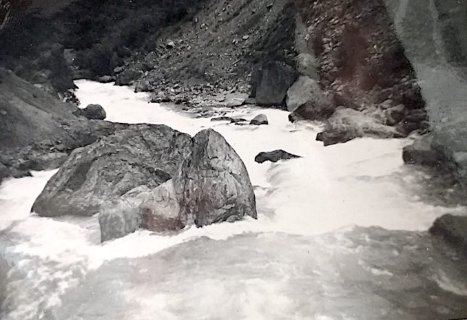
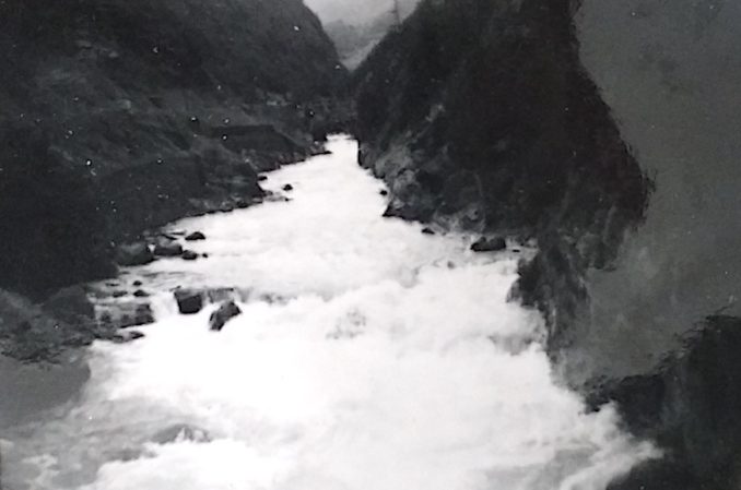
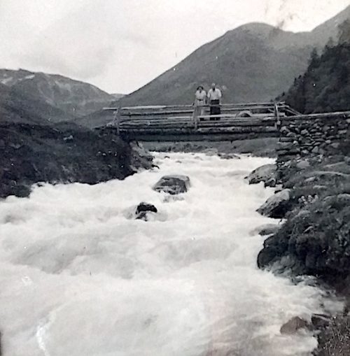
En route (although it might be Tourmalet, for once the album captions are unhelpful) my grandparents paused for mountain air on a wooden bridge constructed of lashed tree trunks. Beneath them the Gave torrents down the valley on its long and winding way to the Atlantic during which, after a change of name, it passes through our next stop-off. Can you guess where it is? Find out next time on Nostalgia Album!
Addendum
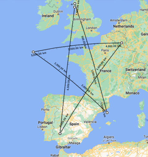
While we’re on the subject, lay lines drawn from Carlisle to previous ports of call at a Barcelona motorcycle factory and Seville create a pentangle with Biarritz at the nadir of an enclosed inverted pentagon. The eastward line passes through Southampton where previously on Nostalgia Album we caught the Queen Mary and the Mauretania in unique alignment.
Astonishingly as it may seem, at the eastern extremity, although an amateur might surmise the pentangle reaches Rochefort, it doesn’t, rather hovers over the Abbaye Notre-Dame de Saint-Remy. It was at the 13th-century Trappist brewery that during his previous life more interesting your humble author passed the time engaged in a tarot school (that included Hergé’s cousin, two elderly nuns and a penitent former 100 Belgian Franc an hour tart) while in hiding from an Antwerp underworld missing two Rembrandts, half a hundredweight of hash and a consignment of machine guns for Angola.
As I type, in the opposite direction a Mr D. Icke hires a Cornish scallop boat and makes for the 3,000km mark armed with swimming trunks and a street map of Atlantis.
© Always Worth Saying 2022, Going Postal
If we look at the bottom right leg, it passes directly through La Garvanie. On the opposite side of the same extremity sits Rennes-le-Château, exactly 666/1000ths of the way from the centre. Plot spolier. Rennes-le-Château is another Pyreanean location, this time one where historians have proved Jesus and the Magdalene washed up after faking a death on a Golgotha hillside all those years ago. Taps nose.
Extra house points for any Puffins who can find more Nostalia Album, or any other type of, remarkable connections about our newly discovered G-P pentangle.
Apologies to Henry Lincoln et al.
© Always Worth Saying 2022


