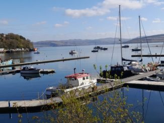
This is another of my favourite places to walk. (In a previous post I covered Llwyn-on.) A quick jaunt from Cardiff eastbound on the M4 to junction 28 then up the A467 will bring you to the Sirhowy Valley Country park. There is plenty of walking available for all abilities. You can amble alongside the river for a bit, or tackle the ascent up to the top of Mynydd Machen and the ridgeway walks. The valley itself is quite unique. It has its own microclimate. Fog and mist can hang around for days. Equally it can be dry when there is rain elsewhere. There is always water here in abundance as many streams flow down to the river.

The Sirhowy Valley
The Sirhowy Valley (Welsh: Dyffryn Sirhywi) is an industrialised valley in the eastern part of the Valleys region of South Wales. It is named from the Sirhowy River (Welsh: Afon Sirhywi) which runs through it. Its upper reaches are occupied by the town of Tredegar within the unitary area of Blaenau Gwent. The valley initially heads south-southeast between the ridges of Cefn Manmoel to the east and Mynydd Bedwellte to the west before turning to a more southerly direction. Its central section is one of the least populated of the Welsh coalfield valleys. The valley enters the unitary area of Caerphilly which contains the towns of Blackwood (Welsh: Y Coed Duon) and Pontllanfraith. It then turns east and joins the valley of the Ebbw River, Ebbw Vale at Crosskeys

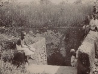
The valley’s industrial history began with ironworks before evolving to meet the demand for coal and the expansion of coal mining. This process was led by companies such as the Tredegar Iron and Coal Company. Coal mines used to be located throughout the valley, including: Wyllie; Nine Mile Point and Oakdale. The Sirhowy passes the old Gelligroes Mill near Blackwood along its path.
Prior to the Beeching Axe, the valley was served by the Sirhowy Railway. Stations could be found at many points including Nantybwch, Argoed, Blackwood, Pontllanfraith and Ynysddu.

The Sirhowy Valley Country Park

Two large warm summer meadows on the banks of the Sirhowy River. It’s an ideal location for butterflies and moths that feed on the profusion of wildflowers. The locally scarce Marsh Pug Moth and the Small Pearl Bordered Fritillary both make their home here. In the spring the small pond is a seething mass of amorous amphibians. Herons pop in for a frog feast as well. In the evening Daubenton and Noctule bats flit across the meadow.

Graig Goch is an ancient oak and beech woodland set in the Sirhowy Valley Country Park. The best time to visit is in the springtime when the woodland floor is carpeted with Bluebells. Springtime also brings the woods alive with birdsong; redstarts, flycatchers and warblers can all be heard as they look for a mate. Part is common land other parts forestry commission. Some small private smallholdings are also dotted around.

Mynydd Machen

Mynydd Machen is a 362-metre-high (1,188 ft) hill lying between the town of Risca and the village of Machen in Caerphilly County Borough in south Wales. Its summit is crowned by a trig point and a mast. There can be some wonderful views from the top on a clear day. Alas the weather is not always kind!

Geology

The hill lies at the southeastern extremity of the South Wales Coalfield where the varied Carboniferous Period rock strata of the coalfield margin are tilted steeply northwestwards into the coalfield basin. The sequence which outcrops on Mynydd Machen in northeast-southwest aligned bands is this (oldest at base):
Warwickshire Group,Pennant Sandstone Formation, Brithdir Member, Rhondda member, Deri Member, South Wales Coal Measures Group, South Wales Middle Coal Measures Formation, South Wales Lower Coal Measures Formation, Marros Group, Bishopston Mudstone Formation, Twrch Sandstone Formation, Pembroke Limestone Group. The summit of the hill is formed from the sandstone of the ‘Brithdir Member’ of the Pennant Sandstone Formation. A large quarry towards the south of the hill works the dolomitic limestone of the Pembroke Limestone Group.

Machen common always seems open and wild. It is always windy and most of the time there is not another soul about. Some cattle roam free, so you need to keep an eye out for the bull. From here you can see all the way to the beacons. At times with snow on top.

(Made using information from Wikipedia using the Creative Commons license. Photos by Jonathon Davies)
© Jonathon Davies 2018